Why Small Drone Crews Outperform Traditional Exploration Models in Remote Terrain
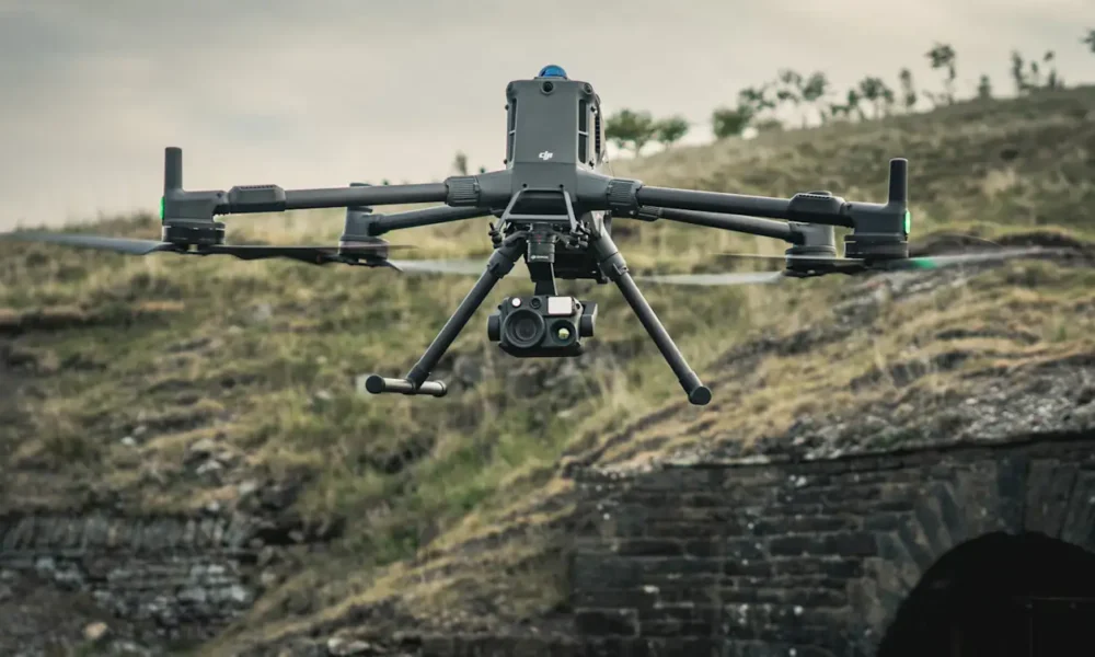
Compact drone teams are redefining remote exploration by trading heavy convoys and helicopters for agile two- or three-person crews. Lightweight airframes and modular payloads fit in a pickup or bush crate, reaching ridgelines and braided valleys quickly. High-resolution LiDAR and magnetic sensors collect mapping and geophysical data with minimal setup and low environmental impact.
Fast on-site processing converts LiDAR and magnetic reads into centimeter-grade maps within 24 to 48 hours, allowing immediate target validation and reprioritization while weather and access windows remain open. These mobile workflows shorten logistics, cut fuel use, and let geologists focus on results instead of transport. Mobility and precision now define the modern exploration campaign.
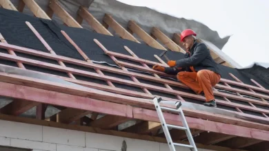
Mobility That Rewrites Logistics
Compact survey kits pack into a pickup or crate for a bush aircraft, reaching steep ridgelines and braided valleys without heavy convoys or helicopters. Lightweight airframes and modular payloads cut setup time so two or three specialists from a drone surveying company can deploy rapidly, collect mapping and geophysical data, then relocate before weather or access limits close in.
Smaller transport needs slash fuel and crew costs while reducing impact in sensitive habitats. Crews run multiple short sorties per day from a truck or light aircraft, maintaining flexible coverage and quick response to changing conditions. This rapid cadence preserves access, improves spatial detail, and lets planners retask flight paths within a single field shift for tighter, more complete mapping.
High-Resolution Data at Scale
Centimeter-grade LiDAR captures fine topography and small geomorphic features, exposing structural breaks and drainage lines that routine field mapping can miss. These dense point clouds let geologists measure offsets, compute slope changes, and flag target corridors quickly. Combining those models with drone-acquired magnetic surveys tightens target definitions before crews commit to drill pads.
In-camp processing pipelines turn raw LiDAR and magnetic reads into georeferenced maps and 3D models on-site, enabling on-the-spot validation against soil samples and hand-held logs. That immediate view lets planners tweak flight lines, change sampling density, or narrow anomaly windows while the crew is still deployed, improving data quality and saving follow-up trips.
Operational Efficiency in Harsh Environments
Compact survey kits and rugged airframes bring capable sensors into terrain unreachable by trucks or large machinery. Systems withstand thermal extremes, gusts, and dust without degrading data quality. Modular batteries and camp-replaceable mounts keep downtime low, while stable flight controls preserve LiDAR and magnetic accuracy through long, demanding survey days.
Teams rotate through short flight shifts to maintain focus and consistency. Automated telemetry and adaptive fail-safes adjust to sudden weather changes, keeping missions productive through heat or subzero conditions. Flexible launch sites, rapid swaps, and hands-free transitions sustain steady coverage, converting harsh terrain from operational risk into consistent, measurable output.
Integrated Workflows That Clarify the Subsurface
Dense dataset fusion lets teams map conductive and resistive zones by overlaying drone LiDAR with electrical resistivity tomography and induced polarization profiles. Correlating surface morphology with subsurface chargeability highlights targets that show both structural control and anomalous conductivity, reducing guesswork before drilling and focusing follow-up surveys on the most promising geophysical signatures.
Magnetic grids tied to lab-analyzed soils provide ground truth and help distinguish geological source signals from cultural noise. Applying spatial statistics and machine learning to stacked geophysical and geochemical layers reveals patterning that manual review can miss, and exporting standardized map products to GIS lets planners share reproducible targets and update schedules based on field-validated results.
Faster Feedback, Smarter Decisions
High-resolution LiDAR and magnetic datasets process within 24 to 48 hours, giving geologists updated layers to cross-check against legacy records while still in the field. Crews can confirm anomalies, refine sampling grids, or redirect flights immediately, keeping exploration momentum without returning to base or waiting for off-site analysis.
Project managers push processed results into GIS and lightweight 3D models viewable from camp. Flight plans and sampling paths update live, letting teams adjust focus while terrain and weather remain favorable. This tight feedback loop keeps data and on-site operations in constant alignment, cutting downtime, reducing transport, and giving each sortie a direct role in real-time decision-making.
Small drone units redefine exploration through agility, precision, and integrated field processing. Two- or three-person teams deploy LiDAR and magnetic sensors from pickups or bush aircraft, collecting high-resolution readings without convoys or helicopters. Results process within 24 to 48 hours, enabling real-time target validation and redeployment before weather shifts. Lightweight logistics lower cost and environmental impact while modular systems thrive in rugged terrain. Fusing geophysical and geochemical datasets inside standardized GIS workflows reduces uncertainty before drilling. The approach accelerates discovery, strengthens confidence in results, and keeps exploration adaptive from first lift-off to final target map.